This webpage contains resources, activities and suggestions to complement the teaching of a case study on marine research aimed at Key Stage 3 and 4, focusing on mapping the physical properties of the seafloor.
You can visit the Using our teaching resources webpage to find out what is on offer.
 How do we map the seafloor?
This case study explores the methods archaeologists, geologists and ecologists used to create maps of the seafloor. These maps will inform marine planning, allowing us to use the sea sustainably without damaging our underwater physical and natural heritage.
The case study supports the curriculum by providing a real-life application of science in the workplace. We will explore how scientists collect and use data about the physical properties of the seafloor, examining different fieldwork methods, such as geophysical survey, sampling and using Geographic Information Systems.
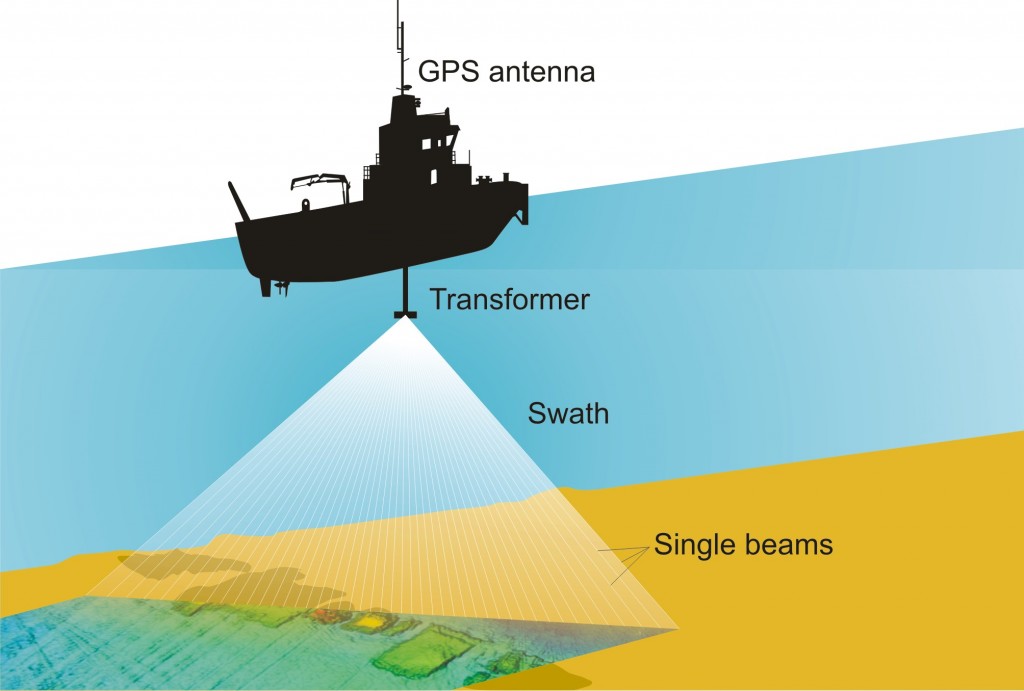
In particular we will look at the use of sound waves in geophysical survey.
We recommend starting with the teacher pack, which has all the background information you need to understand this case study.
Case Study
- Physics Teaching Pack (PDF)
- How do we map the seafloor? (PowerPoint Presentation)
- How do we map the seafloor? (PDF version)
Lesson Image Bank
Click on the link and scroll back down to view the images in the lesson image bank.
E-Game
- Be a Seafloor Explorer (online web game)
Interactive Whiteboard Lessons (currently SMART board)
Film
- Prehistoric Climate Change Animation (Download film as MP4 file)
- Fly-through: 3-D model of the South Coast seafloor (Download to Media Player)
- Talk to the Scientist why do we map on the seafloor (ecology: download film as MP4 file)
- Exploring an Aircraft Wreck (archaeology: download film as MP4 file)
You can find the Palaeo-Arun reconstruction at Wessex Archaeology’s own channels.
-
Fly through: palaeo-Arun prehistoric reconstruction (download film as MP4 file)
- Link to Wessex Archaeology Vimeo channel
Activity Sheets (PDFs)
Explore the Seafloor website also offers
- Information about each Regional Environmental Characterisation
- Image Bank
- Marine Careers
- Explore the Seafloor: Interactive map
- Online GIS
- Scientific Data (graphs, tables and figures taken from the original reports)
- Links to other MALSF outreach material, the original reports and much more.


