Geologists studied the formation and structure of the South Coast seafloor – how it was shaped, what the sediment cover on the seafloor is made of and what rock formations lie beneath the seafloor sediments. This information is vital to the RECs, creating maps of the seafloor for other scientists to use.
Geologists use two main methods to study the seafloor and underlying sediments and rocks. Geophysical survey techniques use sound waves to map the seafloor morphology, the thickness of seafloor sediments and the rocks underlying these sediments. They also take samples of the seafloor sediments and underlying rocks using grabs and vibrocores to ‘ground truth’ the geophysical surveys.
The geological maps form an essential foundation for the South Coast REC archaeological and ecological research and interpretations. They help identify where humans might have lived when sea levels were lower, exposing the seafloor, and on what type of sediment certain groups of animals prefer to live today.
South Coast Geology REC Results
This section provides a summary of the South Coast REC results for the geological research.
Click on links below to find out about each topic, or scroll down to read the entire text.
- What does the seafloor look like?
- What is the seafloor made of?
- Geological timechart
- Underneath the seafloor
- How is the seafloor made?
You can find out more about the scientific research techniques mentioned in the text by visiting our “How we study seafloor” webpages.
You can find out more about the role of geology in other areas of the REC research by visiting the South Coast Ecology, Archaeology and Sustainability webpages.
 What does the seafloor look like?
An important task for the South Coast geologists is to understand the morphology of the seafloor. This involved creating a 3-Dimensional map of what the seafloor looks like.
Geologists added the new geophysical survey data to existing datasets to create a map of the modern seafloor. They effectively stripped away the water so that they could visualise the seafloor as if it were part of the mainland, complete with undersea valleys and hills. The map highlights any geological features on the seafloor, for example old river channels that cut through the seafloor.
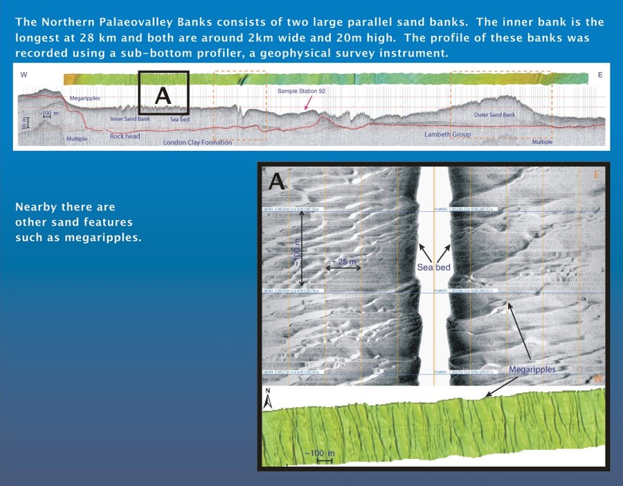
Sand is the most mobile sediment in the South Coast area. Active sea currents move the sand around creating features on the seafloor, for example large sandbanks.
What is the seafloor made of?
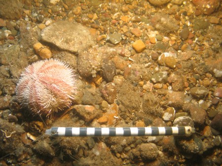
The seafloor is formed of a layer of loose or ‘unconsolidated’ sediments. Geologists studied samples of the South Coast seafloor sediments to understand what they are made of.
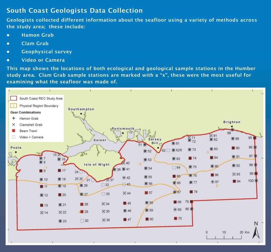
Out on the boat, geologists took seafloor sediment samples across the South Coast REC study area, using a range of different sized grabs. In addition, they used geophysical survey techniques to measure the thickness of these modern sediments.
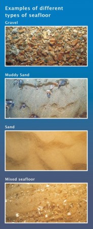
Geologists examined the particle size and properties of all the seafloor sediment samples from the different locations. They classify the size using a system called Folk Classification.
The mapping of the seafloor properties shows that different areas of the South Coast REC study area are characterised by different types of seafloor sediment. The maps showed that 75% of the South Coast REC study area consists of only a thin layer of mainly sandy gravels or gravelly sands, covering the older bedrock layers. You can find out more about the older deposits below. These seafloor deposits are Holocene sediments, laid down during the last 11,700 years.
The sea can affect the distribution of seafloor sediments, for example to the south of the Isle of Wight the seafloor is very gravelly. This is because the sea current has moved all the light sand away from this area.
Geological timechart
Underneath the seafloor
Underneath the unconsolidated seafloor sediments, there are older geological deposits that the South Coast geologists also need to understand.
To do this geologists use special equipment called a vibrocorer to push a maximum of six metres down into the seafloor and collect samples. They also use sound waves to look deep into the seabed to see even older and deeper deposits.
Quaternary deposits
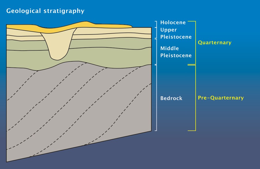
Underneath the loose seafloor sediments in the South Coast REC study area, there is a complex geology of different layers of deposits. These deposits include some formed during the Quaternary period of geological history, which spans the time from around 2.6 million years ago until the present day. These Quaternary deposits are mainly sand and gravel and have filled some of the old river channels which existed in the area.
Bedrock
Beneath the Quaternary deposits lies true rock; this is called ‘bedrock’. It is millions of years old.
Bedrock is the first cemented layer of the earth’s surface. It can be made of a variety of material, for example sandstone, mudstone or chalk. The chalk covers a large area of the seafloor south of the Isle of Wight. Bedrock can be hard and form ridges and small steps on the sea floor.
 How is the seafloor made?
Geologists need to understand the geological processes that created the South Coast seafloor, over a period of time which spans millions of years.
Bedrock
Bedrock is formed when unconsolidated sediments are pressed, compacted and heated until they become solid.
The oldest bedrock is over 150 million years old and was formed during the Jurassic Period. Since then the South Coast area has been covered by land and sea at different times and layers of rock were laid down including thick deposits of chalk, sandstone and mudstone. Over these 150 million years these rocks have been moved and some have been eroded by rivers and the sea, to leave us with different rocks across the South Coast REC area.
Quaternary Deposit
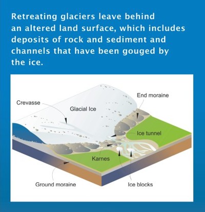
During the last Ice Age, the South Coast REC area was not covered in ice but there was a massive ice sheet to the north across Northern England and the North Sea. Unlike the other REC areas the glaciers had no direct affect on the formation of the seafloor. The seafloor in the South Coast area is dominated by ancient river channels.
Since the last Ice Age: seafloor sediments
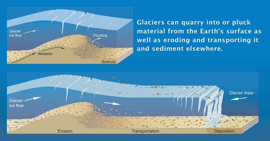 When there were glaciers across Britain, sea levels were low, so at this time the South Coast REC area was dry land. When the climate warmed up, about 10,000 years ago, the ice melted and retreated, leaving sediment in the old river channels.
For a few thousand years the area was dry land, vegetation grew and people probably lived there by rivers and lakes. As the climate continued to warm, sea level rose and by approximately 8,000 BP the area was flooded by the sea.
The sea moved sediments, creating sand waves and sandbanks that can be seen today on the sea floor. In the west of the South Coast REC study area, strong currents removed the finer sediments, leaving the gravel seafloor present there today.
Today, the continued activity of sea currents and tides means that the sediment distribution and seafloor morphology may change in the future. Any change will affect the habitats of the sea animals, whose presence and distribution are dependent on the type of seafloor sediment. You can discover more on our Sustainability webpages.

