Skip to posts

Explore the Seafloor

  • Home
  • About
    • About Explore the Seafloor
    • Event & Roadshow Summary
    • Blog
    • Feedback
  • RECs
    • What is a REC?
    • How we study the seafloor
      • Ecological research methods
      • Geological research methods
      • Geophysical survey
      • Archaeological research methods
    • South Coast REC
      • Archaeology
      • Ecology
      • Geology
      • Sustainability
    • Outer Thames Estuary REC
      • Archaeology
      • Ecology
      • Geology
      • Sustainability
    • East Coast REC
      • Archaeology
      • Ecology
      • Geology
      • Sustainability
    • Humber REC
      • Archaeology
      • Ecology
      • Geology
      • Sustainability
  • Interactive Map
  • Resources
    • Image Bank
    • Seafloor Explorer Game
    • Marine Careers
      • Deputy Chief Fishery Officer
      • Marine Geophysicist
      • Maritime Archaeologist
      • Marine Science Communicator
      • Geologist
      • Marine Ecologist
    • Quiz
      • Anemones
      • Blenny
      • Brittlestars
      • Cuttlefish
      • Plaice
      • Shrimps
    • GIS
    • Scientific Data
  • Teachers
    • Using our teaching resources
    • KS3 and KS4 Biology
    • KS3 and KS4 Geography
    • KS3 History
    • KS3 and KS4 Physics
  • Links
  • Contact Us
  • Latest Posts
  • Latest Comments

Project

Wessex Archaeology
This project is brought to you by Wessex Archaeology on behalf of the Marine Aggregate Levy Sustainability Fund.

The Marine Aggregate Levy Sustainability Fund

Follow us

Facebook Flickr Twitter YouTube RSS

Supported by

British Geological Survey


Emu Limited
Sussex Sea Fisheries District Committee


Guardline Environmental

Images tagged "geology"

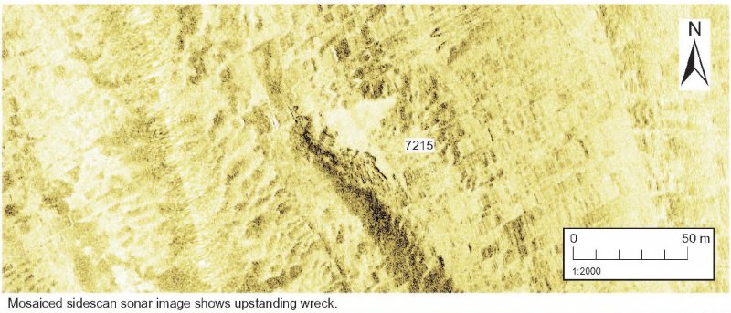
SS Seagull Sidescan Sonar
Geophysical features and landscape characterisation map
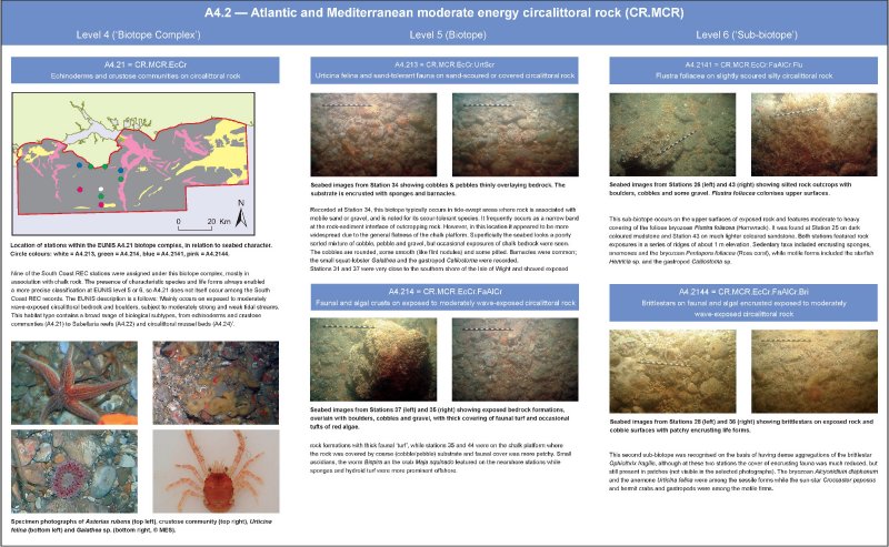
A4.2 Atlantic and Mediterranean moderate energy circalittoral rock, EUNIS level 3 habitat biotope
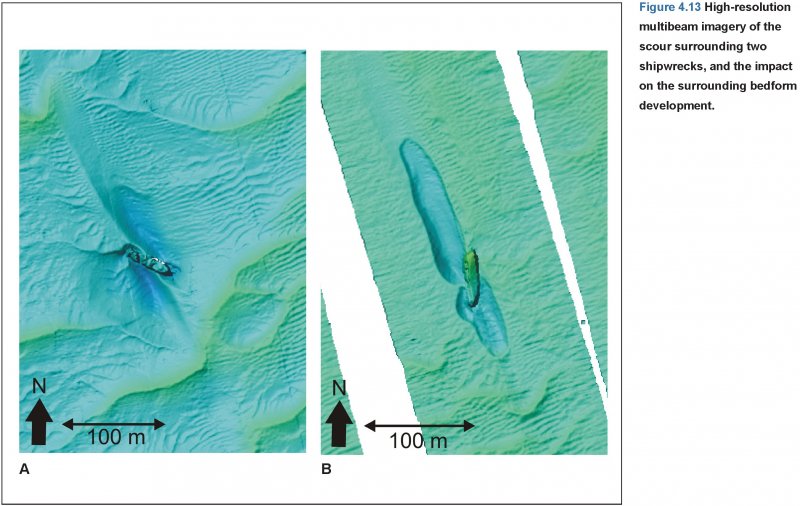
Multibeam image of two shipwrecks
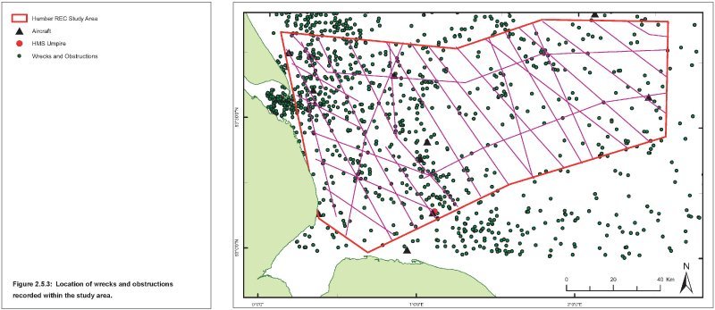
Wrecks and obstructions location map
A4.2 Atlantic and Mediterranean moderate energy circalittoral rock, EUNIS level 3 habitat biotope
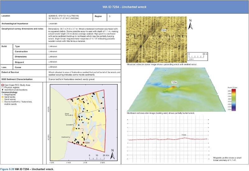
WAID 7254, Uncharted wreck
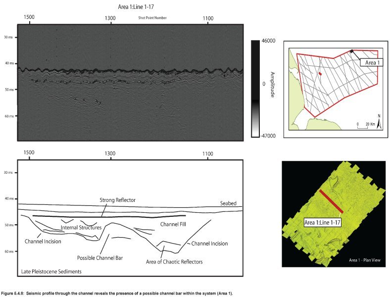
Palaeochannel and potential bar seismic profile in archaeology area1
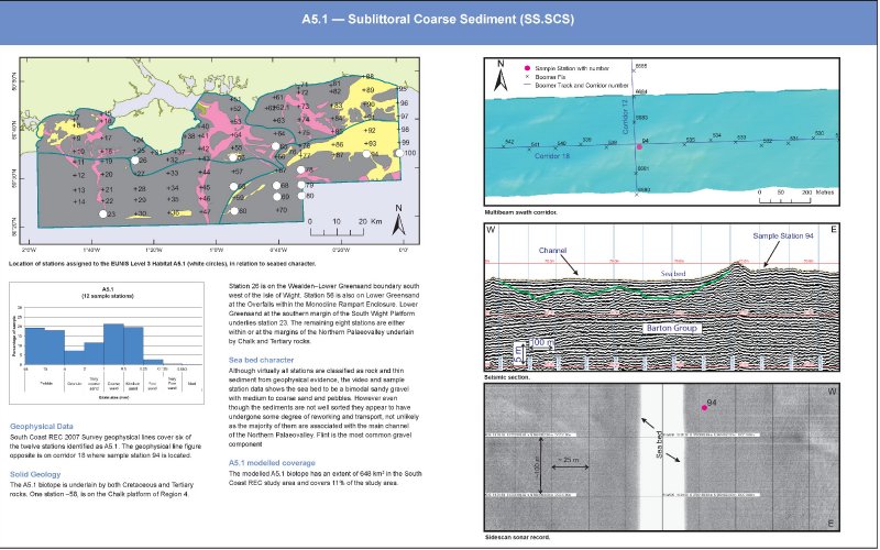
A5.1 Sub-littoral Coarse sediment, EUNIS level 3 habitat biotope
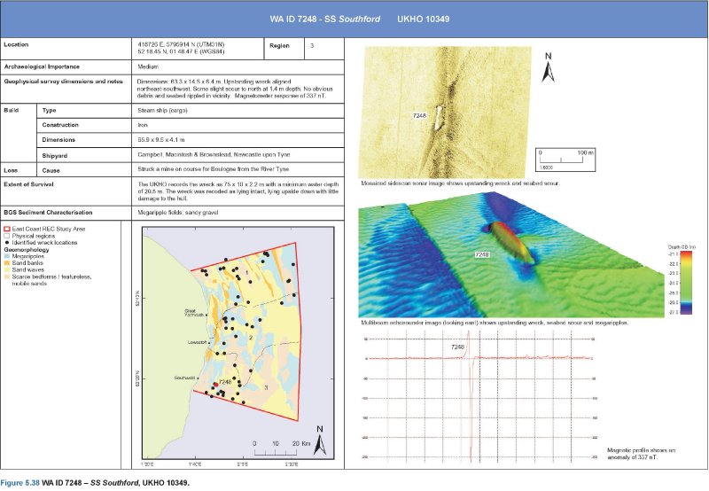
WAID 7248, SS Southford, UKHO 10349
BA1012 an unknown possible wreck
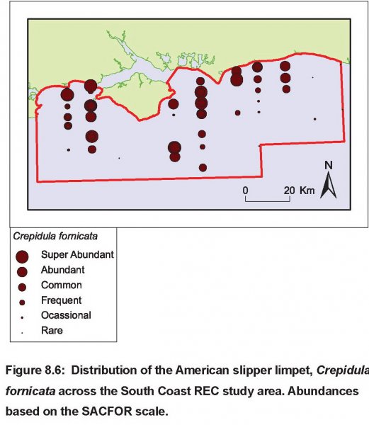
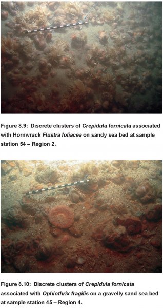
Abundance of REC Americal Slipper Limpets (Non-native species)
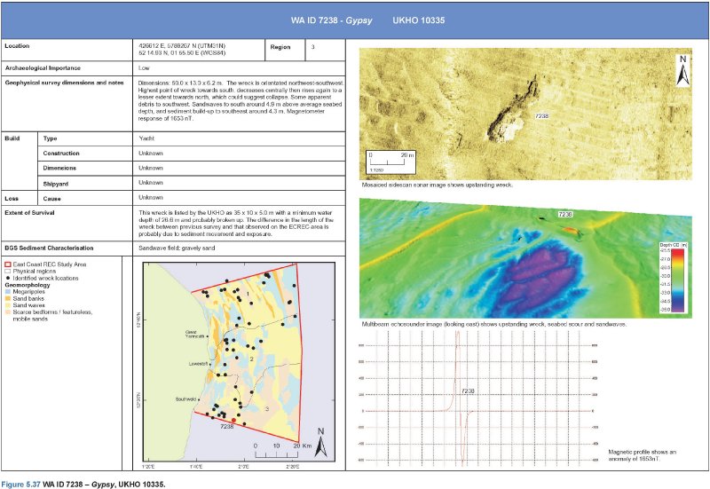
WAID 7238, Gypsy, UKHO 10335
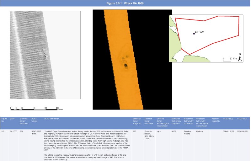
BA1000 HMS Cape Spartel
Non-native species American Slipper Limpets
WAID 7227, SS Stad Alkmaar, UKHO10992
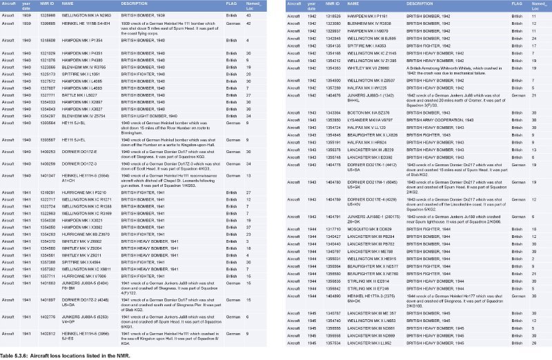
NMR recorded WWII aircraft loss locations
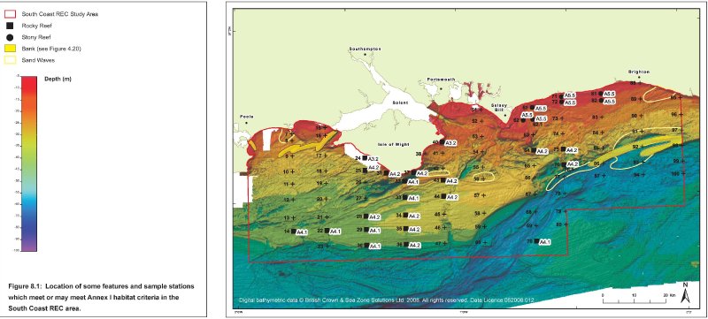
Distribution map of probable Annex1 habitat sites
WAID 7730, Unknown, UKHO 10480
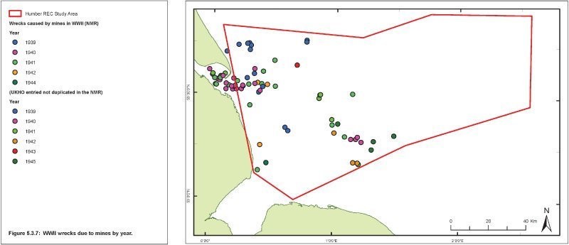
WWII wrecks due to mines
[Show as slideshow]
◄ 1 ... 15 16 17 18 ►
  • Comments (11)

Comments are closed.
Powered by WordPress Web Design by SRS Solutions © 2026 Explore the Seafloor Design by SRS Solutions