Skip to posts

Explore the Seafloor

  • Home
  • About
    • About Explore the Seafloor
    • Event & Roadshow Summary
    • Blog
    • Feedback
  • RECs
    • What is a REC?
    • How we study the seafloor
      • Ecological research methods
      • Geological research methods
      • Geophysical survey
      • Archaeological research methods
    • South Coast REC
      • Archaeology
      • Ecology
      • Geology
      • Sustainability
    • Outer Thames Estuary REC
      • Archaeology
      • Ecology
      • Geology
      • Sustainability
    • East Coast REC
      • Archaeology
      • Ecology
      • Geology
      • Sustainability
    • Humber REC
      • Archaeology
      • Ecology
      • Geology
      • Sustainability
  • Interactive Map
  • Resources
    • Image Bank
    • Seafloor Explorer Game
    • Marine Careers
      • Deputy Chief Fishery Officer
      • Marine Geophysicist
      • Maritime Archaeologist
      • Marine Science Communicator
      • Geologist
      • Marine Ecologist
    • Quiz
      • Anemones
      • Blenny
      • Brittlestars
      • Cuttlefish
      • Plaice
      • Shrimps
    • GIS
    • Scientific Data
  • Teachers
    • Using our teaching resources
    • KS3 and KS4 Biology
    • KS3 and KS4 Geography
    • KS3 History
    • KS3 and KS4 Physics
  • Links
  • Contact Us
  • Latest Posts
  • Latest Comments

Project

Wessex Archaeology
This project is brought to you by Wessex Archaeology on behalf of the Marine Aggregate Levy Sustainability Fund.

The Marine Aggregate Levy Sustainability Fund

Follow us

Facebook Flickr Twitter YouTube RSS

Supported by

British Geological Survey


Emu Limited
Sussex Sea Fisheries District Committee


Guardline Environmental

Images tagged "bathymetry"

Composite geophysical image of the Talis
REC Bathymetry and Feature names
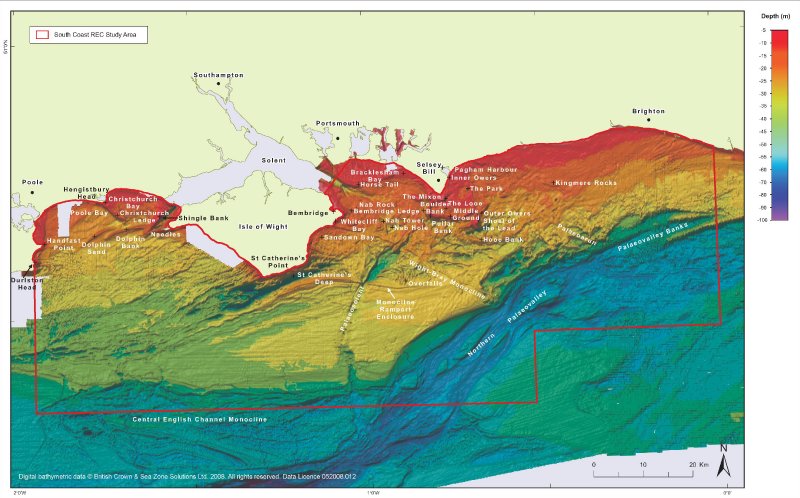
Bathymetry image of the South Coast REC Study Area showing named places
REC Bathymetry of inner gabbard deeps and Sidescan sonar data images of palaeo-rivers
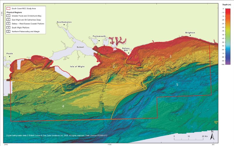
Bathymetric image of the South Coast REC Study Area showing the Physical Regions 1 to 5
REC Bathymetry and Sidescan sonar data showing palaeo river systems
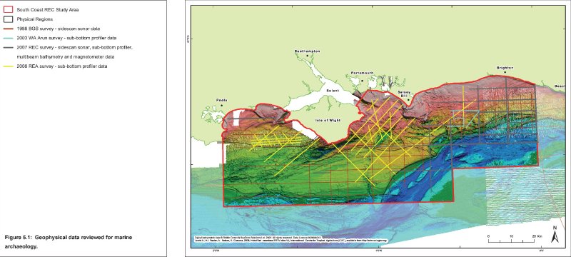
Bathymetry image with geophysical survey types, lines and dates
Terkunimaru - Bathymetry and Sidescan sonar data images examples
The Palaeoarun and its environment.
Wreck of the SS Pagenturm with sidescan and bathymetry data images
Unidentified wreck with sidescan data and bathymetry data images
Bathymetry image of the South Coast REC Study Area showing named places
The Palaeoarun and its environment.
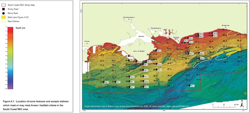
Distribution map of probable Annex1 habitat sites
[Show as slideshow]
  • Comments (11)

Comments are closed.
Powered by WordPress Web Design by SRS Solutions © 2026 Explore the Seafloor Design by SRS Solutions